
ROUTE MALPICA – NIÑÓNS
SUNDAY, MAY 25
We begin the stage in the port of Malpica and, a few kilometers away, we already realize all the magic that this route contains. A very fun path with some degree of difficulty that will leave you with images at every step on a coast of great diversity. Inlets with beautiful beach are interspersed with cliffs colonized by cormorants and seagulls until reaching the Punta Nariga Lighthouse, located in an environment of rocks of great beauty. Niñóns Beach is the end of a stage that will introduce us to this world of trasnos.
Difficulty HIGH
21.3 kilometers
8 hours
+- 800 m/slope


Make your reservation for the GWF Camiño dos Faros Program


In the port of Malpica we begin this adventure of Camiño dos Faros. During the great winter storms, this kilometer 0 of the route receives the brutal jolts of the waves, which easily pass over the breakwater.
Malpica has a past linked to its fishing port and whale fishing. Since the beginning of the seventeenth century, with the courage of these sailors and the help of the experienced Basque whalers, there is evidence of their fishing. And it is that this scrambled winter sea was conducive to whales, which circulated in their migrations through the Gulf of Artabro and were sighted from the Sisargas Islands or the Atalaia. This past whale was preserved very recently in some Malpica houses, where its vertebrae were used as a seat and large whale bones even as roof beams.
In the tour we can see the redeiras arranging the rigging and discharges of sardines and other species of the boats that come from the fishing day. In the fish market, fish and seafood catches are distributed in a curious auction while, at the border of the pier, fishermen with their rods have a fun time fishing for squid. All this, under an intense squeak of seagulls that tirelessly seek their food at sea and on land.
Inside the dock, the boats rest perfectly aligned waiting for the next ‘tide’. On it, the constructions are stacked against each other as in a Tetris, looking for the port and forming a very irregular set and, at the same time, very charming.
The promenade of Caldeirón is the first meeting of Camiño dos Faros with the open sea. From there we see how the sea breaks on the rocks and we already have a panoramic view of the beach, the Sisargas Islands and part of the path to San Adrián. We cross the low tide of the Area Maior Beach to enjoy this smell of the Costa da Morte. This beach is the first of the 50 beaches that exist on this trail.
From Seaia to the Cape of San Adrián there is a path that borders the mountain always facing the sea and with great views of the town of Malpica. We recommend you drink water at the first source. On the cape is the Hermitage of San Adrián. According to legend, in the fifth century, San Adrián arrived in these lands to Christianize them and eliminate pagan cults, symbolized in the serpe (snake), a struggle from which he won. The chapel was built in the sixteenth century and renovated in the twentieth century and, in its immediate vicinity, a busy pilgrimage is celebrated in mid-June. There, at San Adrián Viewpoint, we make the first stop of this Camiño dos Faros, contemplating the path we have walked from Malpica.
If we look to our left we can see the Sisargas Islands, located a short mile. This small uninhabited archipelago is formed by the Grande, Chica and Malante Islands as well as several islets. Formerly they were populated as evidenced by the existence of the hermitage of Santa Mariña, destroyed by pirates in their multiple incursions during the 10th century. This natural reserve has a great wealth of flora and fauna, nesting its cliffs several species of birds in danger of extinction that the islands choose to breed and also as a stage of passage in their long migrations. Species such as the cormorant, the tridactila seagull and the dark seagull of the Sisargas find a perfect habitat on the cliffs of the northern part of the Island.
The lighthouse, built in 1919, has been a silent witness and guide for years of fishing vessels, merchants and large tankers that cross this sea corridor. Until not long ago, the lighthouse keeper remained for 15 days in the solitude of the island until he was relieved.
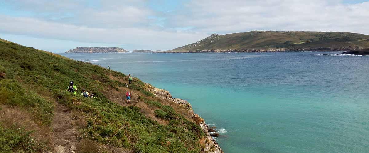
The path to Beo is spectacular and not very complicated, except in small sections where the proximity of the cliff can give us some vertigo. The sea of this Canal das Sisargas breaks hard and we already have the sensation of adventure in our body.
Beo Beach is located in the parish of the same name, very sheltered from the northeast, so present in this area. The locals know it and visit it in the summer months. It has a small picnic area with stone tables and chairs. There we will make the first refreshment stop at this stage of Camiño dos Faros. At the exit of the beach, we find a stone laundry with a fountain and the small port of Tella, a natural port encased between these rocks of Beo. Then we skirt Punta Galiana, passing through the two walls and the moat that defended the Castro de Entretorres, one of the few maritime castros in the area and totally without studying.
When we arrived at Seiruga Beach, we found a difficulty along the way: you have to cross that little stream. Although at low tide it is simple, if the tide is high it can get a little complicated. But you have to take off your shoes, raise your pants above your knees and cross. In the months of more water (January-March) it can go so full that it covers your chest. In that case, you should take the alternative path that leaves Beo. The wetland of Xuncal do Martelo is chosen by ducks, herons or otters to nest or rest from their trips. A great landscape environment both at high tide and low tide.
From there we take the coastal path that approaches us through Punta Cherpa, always with the Sisargas in front, to Barizo. In the Garzas Stone we can contemplate the sea when it is enraged. The waves break near the shore and the show is guaranteed. From there we see the whole Ensenada de Barizo, with the Restingas de Co and the vastness of Mount Nariga, our next objective. The only services until the end of the stage are located on that road, with a rural house and several restaurants.
We cross Barizo Beach until we reach the small port with local boats, where amateur fishermen try to fish some squid on summer nights.
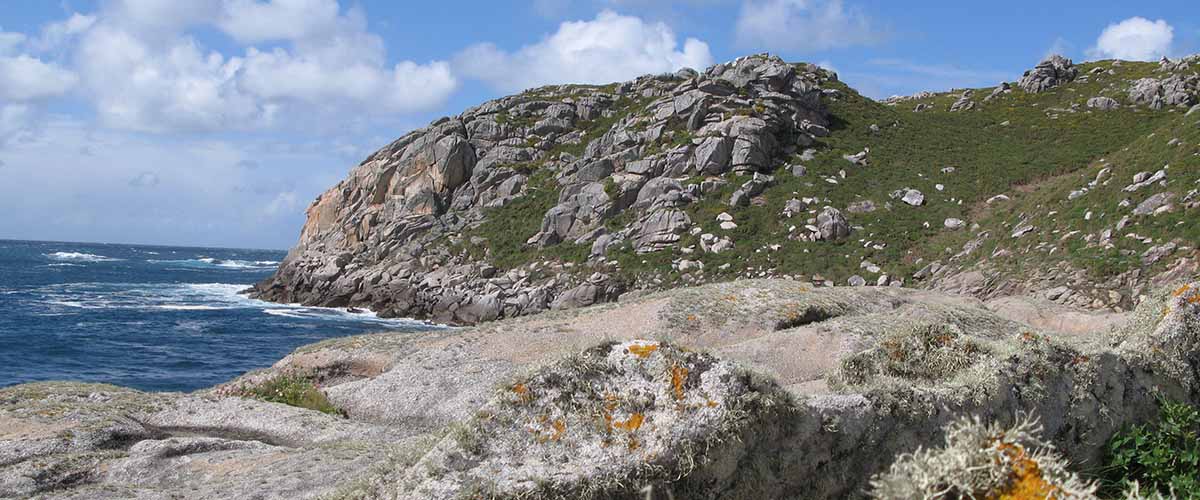
From the Port of Barizo, the most difficult section of this stage begins. The 3 kilometers that separate us from the Nariga Lighthouse take us along a spectacular coastal path, but narrow, irregular and with large slopes. The climb is hard, so we recommend making the necessary stops, resting on the flat rocks and admiring the spectacular landscape of the entire bay. Large granite formations, molded by water and wind with the most varied forms, dot this part.
The environment of Punta Nariga is full of magic. The strong wind prevailing during many times of the year led to the installation of a wind farm in its vicinity. Along the way we will see large rocks in the most varied ways. Upon arriving at the lighthouse we see the construction that simulates the bow of a ship entering the sea. It has a height of 50 meters and a range of 22 miles. In the mask, the Atlantean sculpture becomes the perfect place for the photo. Being very careful we can walk through the rocks on which the lighthouse is located and that have unique sculptures due to the constant erosive action of water and wind.
It is the first lighthouse we visited on our way and here we realize why the name of the route. In addition to being essential elements in this Costa da Morte, from this position we contemplate to the right a large part of the route in this first stage and, looking to the left, we see the beginning of the next. That is something that will accompany us in The Lighthouse Way, the wide panoramas of the journey and what remains to be traveled.
O Camiño dos Faros, after visiting Punta Nariga, is always attached to the sea on the way to the Enseada do Lago and Niñóns along a spectacular stretch of coastline. They are small cliffs that we cross through the middle, through a somewhat demanding path while we watch as the sea breaks in this impressive mass of stone that is Punta Nariga.
The Enseada do Lago, oriented to the West and well closed by the Insuas do Lago and Punta Queimada, offers a haven of tranquility and a rest to our legs before reaching Niñóns. A section to reflect how this first stage of this Camiño dos Faros has been, that has everything and that is a faithful reflection of the rest: variety of landscapes and a demanding route in a virgin environment that we must keep as it is for the future.
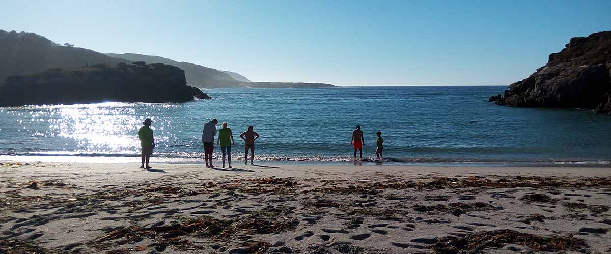
The first stage of O Camiño dos Faros ends at Niñóns Beach, very quiet and surrounded by an environment of pine trees that make it a good place to spend the day.
Route Planning
| Km Stage | Point | Height (m) | Km Total |
| 0,0 | Port of Malpica | 6 | 0,0 |
| 1,0 | Area Maior Beach | 8 | 1,0 |
| 2,6 | Seaia Beach | 4 | 2,6 |
| 2,9 | Navenllos (good water source) | 37 | 2,9 |
| 3,5 | Romeiros Spring | 51 | 3,5 |
| 4,0 | Hermitage of San Adrián | 68 | 4,0 |
| 4,0 | San Adrián Viewpoint | 68 | 4,0 |
| 5,2 | Cape of San Adrián | 21 | 5,2 |
| 8,6 | Beo Beach | 7 | 8,6 |
| 9,1 | Beo water source | 13 | 9,1 |
| 9,5 | Port of Tella | 14 | 9,5 |
| 9,9 | Castro de Entretorres | 14 | 9,9 |
| 10,6 | Seiruga Beach | 2 | 10,6 |
| 12,3 | Cherpa Point | 14 | 12,3 |
| 13,7 | Bar Xan | 7 | 13,7 |
| 14,2 | Barizo Beach | 0 | 14,2 |
| 15,1 | Port of Barizo | 21 | 15,1 |
| 17,2 | High-point of As Barreiras | 131 | 17,2 |
| 18,3 | Punta Nariga Lighthouse | 41 | 18,3 |
| 19,2 | Rubio Point | 62 | 19,2 |
| 20,2 | Lago Insel | 8 | 20,2 |
| 21,9 | Niñóns Beach | 5 | 21,9 |