
ROUTE ALDÁN – DONÓN
THURSDAY, MAY 22
The Aldán Estuary cannot be considered estuary because it is not formed by the mouth of the river, but we can say that it is a deep entree of great beauty of the Pontevedra Estuary. In this stage we will travel part of its west bank, full of small coves that we must travel at low tide. In the second half the landscape will change radically, crossing the Costa da Vela and its cliffs that will take us to the Monte do Facho, place of legend and unique viewpoint on the Rías Baixas, to end the stage in the sculpture of the Donón Caracola.
Difficult LOW
12.5 kilometers
7 hours
+418 m, -137 m slope


Make your reservation for the GWF Rias Baixas Program
-
 GWF Rias Baixas 1 Pax Shared Double Room975,00€
 -
 GWF Rias Baixas 1 Pax Single Room1.235,00€
 -
 GWF Rias Baixas 2 Pax Double Room1.950,00€
We begin the stage early in the Porto de Aldán, where the large mussel boats mix with the small boats forming a multicolored frame. In the port is the base of Club de Piraguismo de Aldán, cradle of prominent Olympians such as David Cal (1 gold medal and 4 silver medals) or Teresa Portela (6 Olympic games). From the pier we can see the entire Ría de Aldán, bounded by Cabo Udra on the right and Punta Couso on the left. And, in this small space there are about twenty beaches of fine sand, protected from the winds and with clean and calm waters. It is for something that begins to be known as the Galifornia.

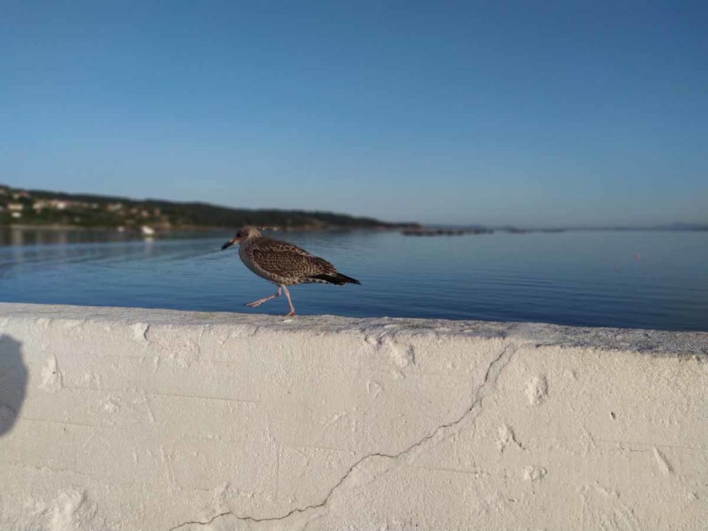
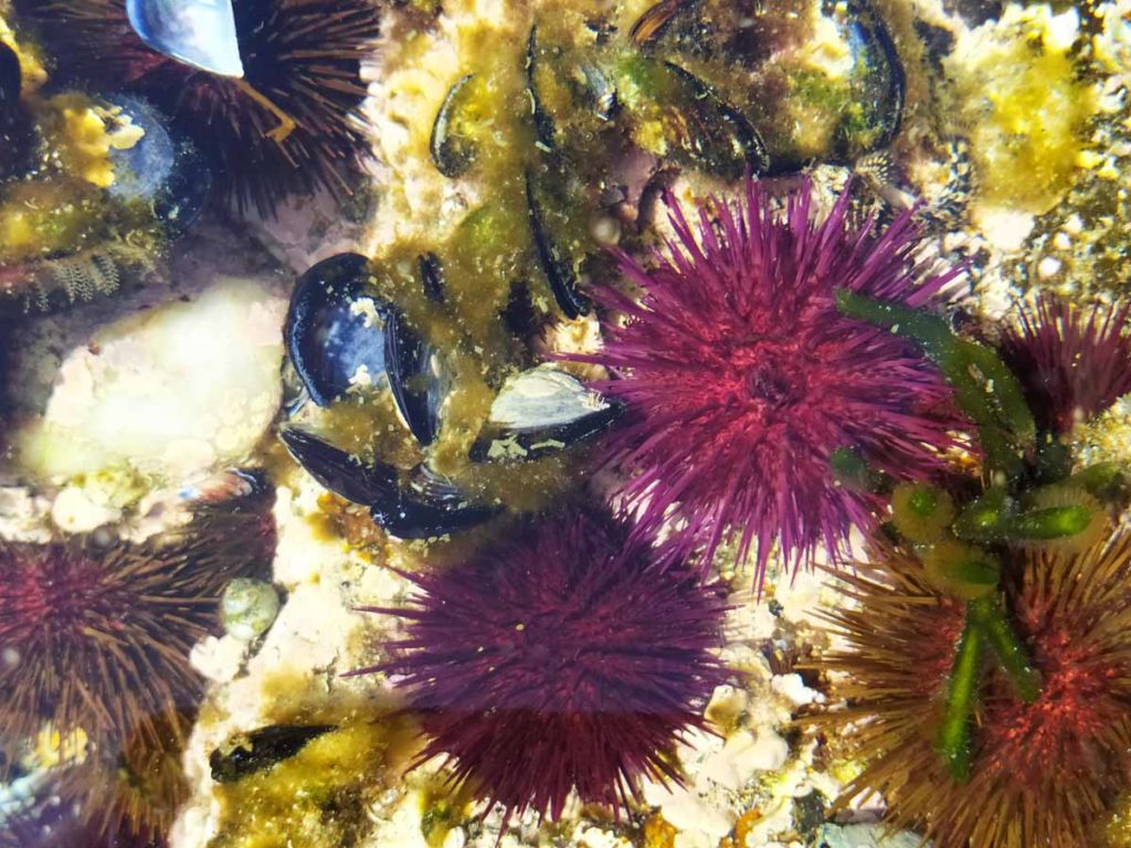
The first beach we find is the Praia de San Cibrán, an urban beach that at low tide forms an intertidal complex that is the habitat of a multitude of seabirds.
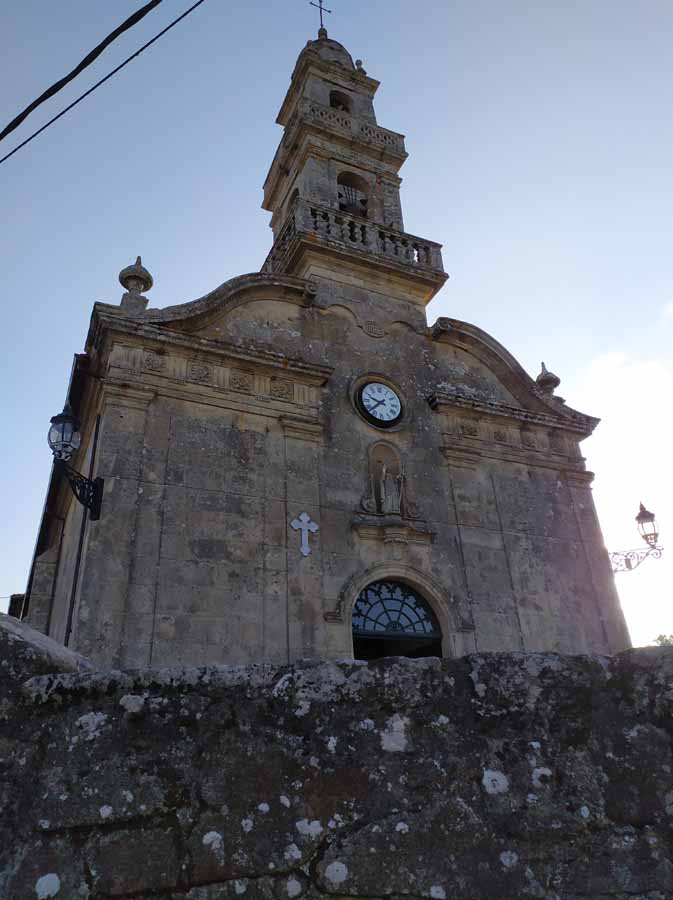
On the beach and surrounded by typical sailor houses with large balconies is the Church of San Cibrán, a neoclassical building built in 1866 on an earlier temple of the 16th century. From a single nave, on the facade we can see the image of San Cibrán with the bishop’s clothing and, in the church’s atrium, a 19th century mausoleum by Antonio Cerviño.

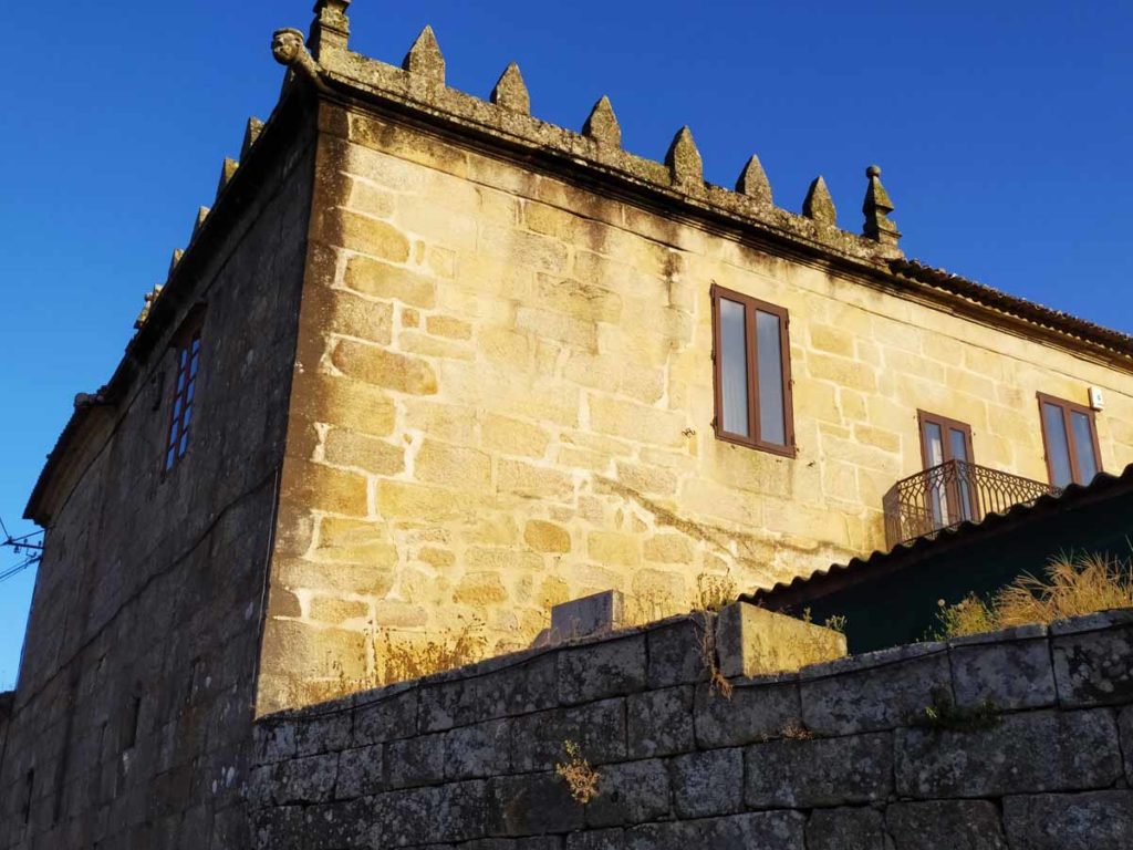
From there begins the wall of the Pazo of Aldán Tower owned by the Counts of Canalejas and which, in its time, covered a large area. Today it is divided between the Tower, with a sober decoration that highlights the battlements and the back garden dedicated to the cultivation of flowers and vegetables. On the other side of the road, we can see the structure of a medieval bridge, an old laundry and the hidden jewel of this route through Aldan.
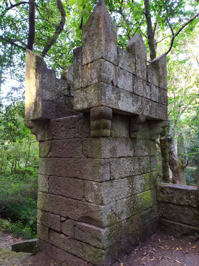
The Finca de Frendoal, former recreational estate of the counts, is an example of an Atlantic native forest a few meters from the sea, an enchanted forest that appears before us without waiting for it. The density and height of chestnut trees, oaks, birches and eucalyptus barely let the sun’s rays penetrate. When you least expect it, a small castle appears, which was built in the 60s for the smallest games and is unfinished. On its cover we can see the shield of the Counts of Canalejas and has a moat all around it, having access from the back. The existing esplanade opposite was used by the counts for their cricket matches.

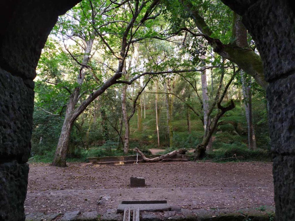
On the walk we can see some stone bench made with ancient sarcophagi, since during the High Middle Ages, between the 5th and 10th centuries AD, there were burials in this area. Next to the castle we see the old aqueduct, an old water channel from a distant mine to the pazo. The origin of the arch is surely Romanesque as it flows into the old pools of the salting factory that the Romans had in the basement of the current Torre de Aldán. Also known as Arco da Moura was partially destroyed by the works of the general road.

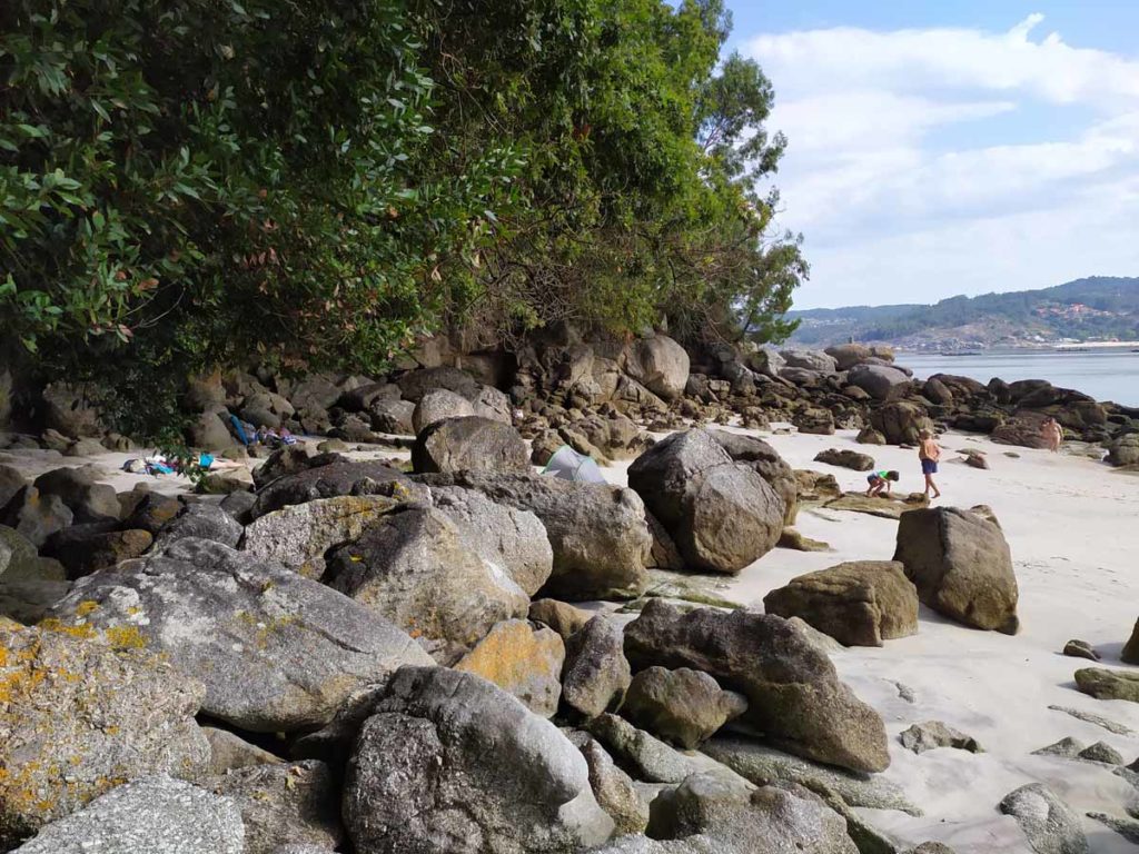
We leave this forest enchanted by the mouth of the Orxas River, which divides the parishes of Aldan and Hío and we begin to explore all the beaches of this west bank of the estuary. To fully enjoy this stage and do it in a comfortable way, it is necessary that we cross all these sand at low tide.
The first one we find is the small Picos Beach that will take us to Punta de Vilariño, where a curious granary at the edge of the sea marks the beginning of the wide Rioesteiro Beach, 500 meters long. In our walk along the edge of the sea we enjoy the tranquility of these waters and the reflections that the small boats anchored create in the mirror of the sea.


Crossing a small dock we arrive at the Testada Beach and, from there, to the spectacular Arneles Beach, place chosen by many yachts to anchor and enjoy all those coves.
In a bucolic environment that nothing has to envy to other places with more popularity, the ruins of the old cannery of Curbera mark the black point to the route. Once a source of wealth for the area, today it is a construction that affects the estuary and poses a danger to walkers.
We continue along the path, bordering the tip where Camping Hío is located to reach Pintens Beach, another visual spectacle of calm and crystalline waters, which we photograph from the rocks. Each of these beaches has its beach bar where you can drink some in the middle of the stage.

The stage is very fun. One after another the coves are happening, each more spectacular, that we go through the edge of the sea until we reach the rocks that separate from each other and that are somewhat more technical. But a little more attention and at the moment a new cove appears surrounded by pine trees and a tranquility that is breathed here as in very few places.
Thus we cross Punta Pinela, Carballal Beach and Pipín Beach, which do not detract from the rest of the route. We would not know how to choose one but the surroundings of Castiñeira Beach, surrounded by forest and huge rocks that create a cool shade, is hard to beat.
This part of the stage well deserves a dip or two in these waters that, in addition to being very clean, are usually not too cold. The stage is short and while we are on this side of the estuary we have to take advantage.
For a moment, the path goes inside before reaching Areabrava Beach, the longest in the entire cove with its 800 meters in length. Focused on the north winds and with a large dune cord, it presents, like all the sand on this route, waters that invite the bath. This will be the last big beach we will visit.

From that moment, the path stops costing and gets a few meters inside between the chalets and private properties, and from which we can quietly access any of the coves. Curres, Estrepeiros, Alada, Foxo and Rabáns are the latter, already more rocky, that we are going to visit on this route along the Ría de Aldán.
Punta Couso has problems moving along its paths, there are private properties that do not allow access to the lighthouse. That is the reason why, from the Rabans Beach, we go inside in continuous ascent until we reach the counterpoint of the stage: the Vela Coast, with its high cliffs towards the open sea.

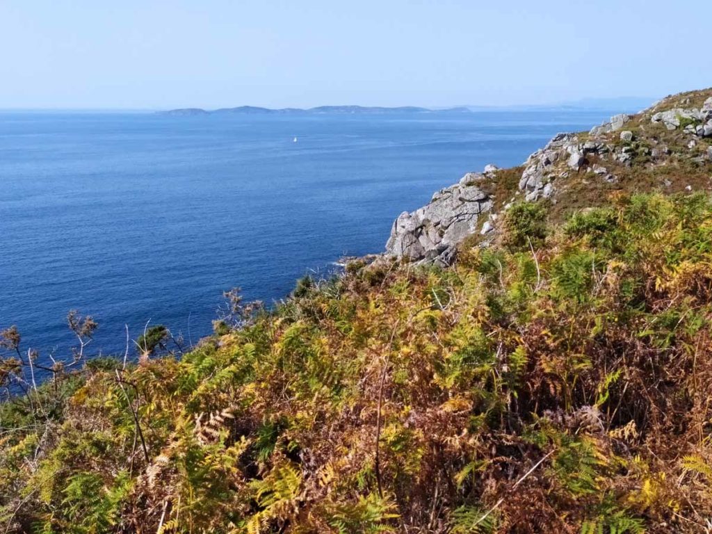
From the Mirador de Couso, 100 meters high, we have a panoramic view of the entire Ría de Pontevedra, with Cabo Udra in the foreground and Ons Island. After the climb, it is time to rest and breathe this tranquility that gives you to remain on the ocean.
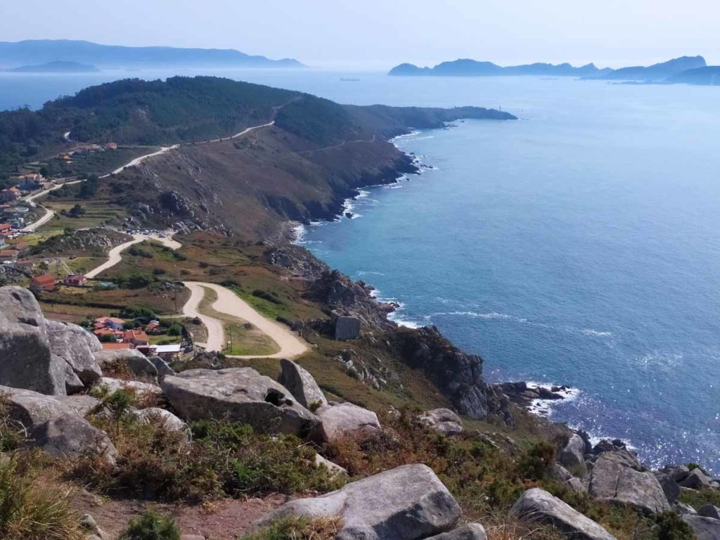
From here, the path runs along a wide path all along the Costa da Vela, where at times we see the sea and others the huge granite rocks that form this massif and are the best viewpoints to this Atlantic, normally enraged and that gives us the contrast with the quiet interior of the estuary.

The trail is designed to make the part of the coves at low tide and with the morning sun giving from the east to later, in the afternoon and with the west sun, do this last part. We recommend bringing enough liquid on this Costa da Vela because there is little shade and the existence of water sources is zero. However, it is a simple path to travel until you reach Monte do Facho, key point of the stage.
The Monte do Facho is another open book in the history of Galicia. Elevated over the Atlantic Ocean, with its 189 meters high and a privileged situation, from its summit you can see all the Rías Baixas perfectly. Its importance is that it has been a place of pilgrimage in several times and with cults to several different divinities, which makes it a unique place not only in Galicia, but also throughout the Iberian Peninsula.
The chronology is as follows:
- Already from the ninth century BC to VII BC. there was a village on the east slope of the mountain.
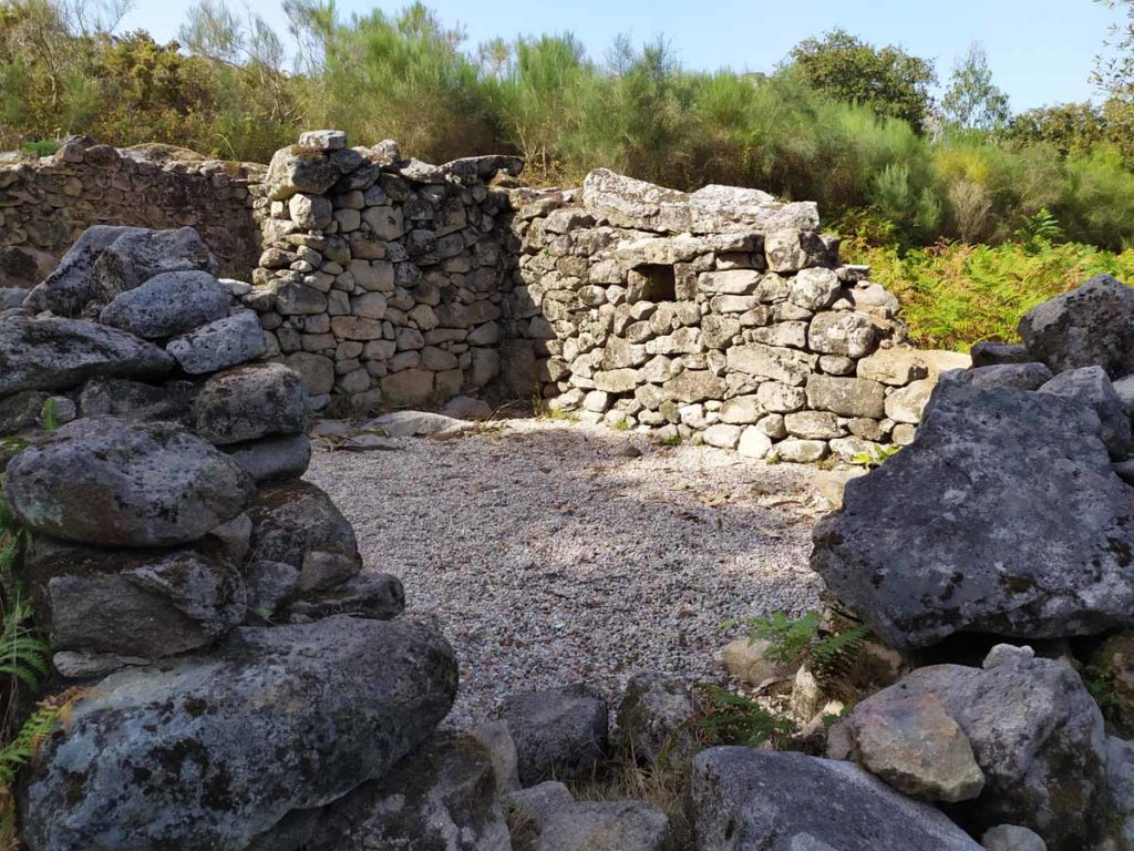
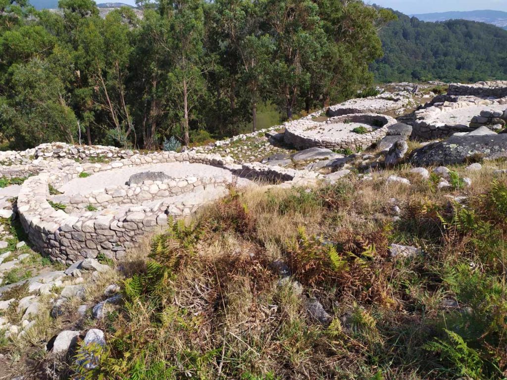
- From the sixth century B.C. Castro de Beróbriga appears, a fortified town that we see at the beginning of the climb, which will remain until the 1st century BC. and of which part of the walls and the moat are still preserved. Some experts argue that this Iron Age castro was already used for worship.
- Later, from the third to the fourth century AD, the Romans arrive who, assimilating the old beliefs of two centuries before and adapting them to the empire, create another Galician-Roman fort as a place of worship on the ruins of the previous one, on a slope that surrounded the top , creating small terraces where they placed their offerings. Its peculiarity is the large number of altars that were found by what is supposed to be, rather than a village to live in, a place of worship, where pilgrims were going to make their offerings to a local God called BeroBreo who had powers Healing The sands were offered to the god by the pilgrims and were raised by the penitent to the top of the summit. Most of the aras appeared with this inscription: «O DEO LARI BEROBREO ARAM POSUIT PRO SALUTE«. Therefore it is a local divinity, unknown until the time of excavations.
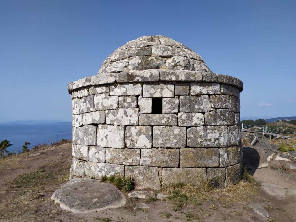
- Finally, in the 18th century, the coastal surveillance post is built from which we can see today the circular structure with walls and stone vault that crowns the mountain. Its basis is on an old medieval lighthouse that was part of the coastal defensive system, which alerted the enemy by making a bonfire with wet straw (facho) that could be seen in many parts of the Galician coast.
Do not hurry down Mount Facho. Absorbing all its magic takes time and the end of the stage is very close. It is one of those strategic places in Galicia, a flight over the sea that will remain forever in the retina.

We descend from Monte Facho on the way to Donón and stop at one of the stones from which to contemplate the south face of this Costa da Vela and the Cabo Home Lighthouse, the closest point to the Cíes Islands and which marks the beginning of the Ria de Vigo
The end of the stage is at the Caracola of Donón, the work of the sculptor Lito Portela who looks defiantly at the ocean and whose intention is for people to enter the bughina and from there listen to the sound of the Atlantic. But we ask you not to climb the sculpture, since the weight of people is causing cracks in the structure.


With a photo in the Caracola with a good sunset and a beer in any of the bars that exist at this point, we end this diverse stage by the Morrazo, which has taken us on both sides of this Galician sea. On the one hand, the friendly face of the interior of the estuary, with its calm and turquoise waters and on the other hand, the open sea, that Atlantic that has roared throughout life on those cliffy coasts.
Route Planning
| Km Stage | Point | Height (m) | Km Total |
| 0,0 | Port of Aldán | 2 | 77,9 |
| 0,3 | Club de Mar Ría de Aldán | 3 | 78,2 |
| 0,5 | O Con de Aldán | 3 | 78,4 |
| 0,5 | San Cibrán Beach | 3 | 78,4 |
| 0,9 | Church of San Cibrán | 9 | 78,8 |
| 1,0 | Aldán Tower | 8 | 78,9 |
| 1,1 | Medieval bridge | 8 | 79,0 |
| 1,1 | Old laundry As Pardellas | 8 | 79,0 |
| 1,3 | Path Enchant Forest | 13 | 79,2 |
| 1,4 | Aqueduct | 17 | 79,3 |
| 1,5 | Castle | 21 | 79,4 |
| 2,0 | Orxas Stream | 0 | 79,9 |
| 2,0 | Alameda | 0 | 79,9 |
| 2,1 | Picos Beach | 6 | 80,0 |
| 2,6 | Rioesteiro Beach | 0 | 80,5 |
| 3,0 | Testada Beach | 0 | 80,9 |
| 3,4 | Arneles Beach | 0 | 81,3 |
| 4,0 | Ruins Curbera’s factory | 2 | 81,9 |
| 4,3 | Ameixide Point | 4 | 82,2 |
| 4,5 | Pintens Beach | 0 | 82,4 |
| 4,7 | Pinela Point | 11 | 82,6 |
| 4,9 | Carballal Beach | 0 | 82,8 |
| 5,1 | Pinpín Beach | 0 | 83,0 |
| 5,2 | Castiñeiras Beach | 0 | 83,1 |
| 6,0 | Area Brava Beach | 0 | 83,9 |
| 6,4 | Curres Beach | 5 | 84,3 |
| 6,6 | Estrepeiros Beach | 5 | 84,5 |
| 6,9 | Alada Beach | 10 | 84,8 |
| 7,1 | Foxo Beach | 4 | 85,0 |
| 7,2 | Rabáns Beach | 4 | 85,1 |
| 8,2 | Punta Couso Viewpoint | 101 | 86,1 |
| 9,7 | Costa da Vela | 100 | 87,6 |
| 11,5 | Castro of Monte Facho | 181 | 89,4 |
| 11,6 | Monte do Facho | 181 | 89,5 |
| 12,6 | Caracola of Cabo Home | 72 | 90,5 |